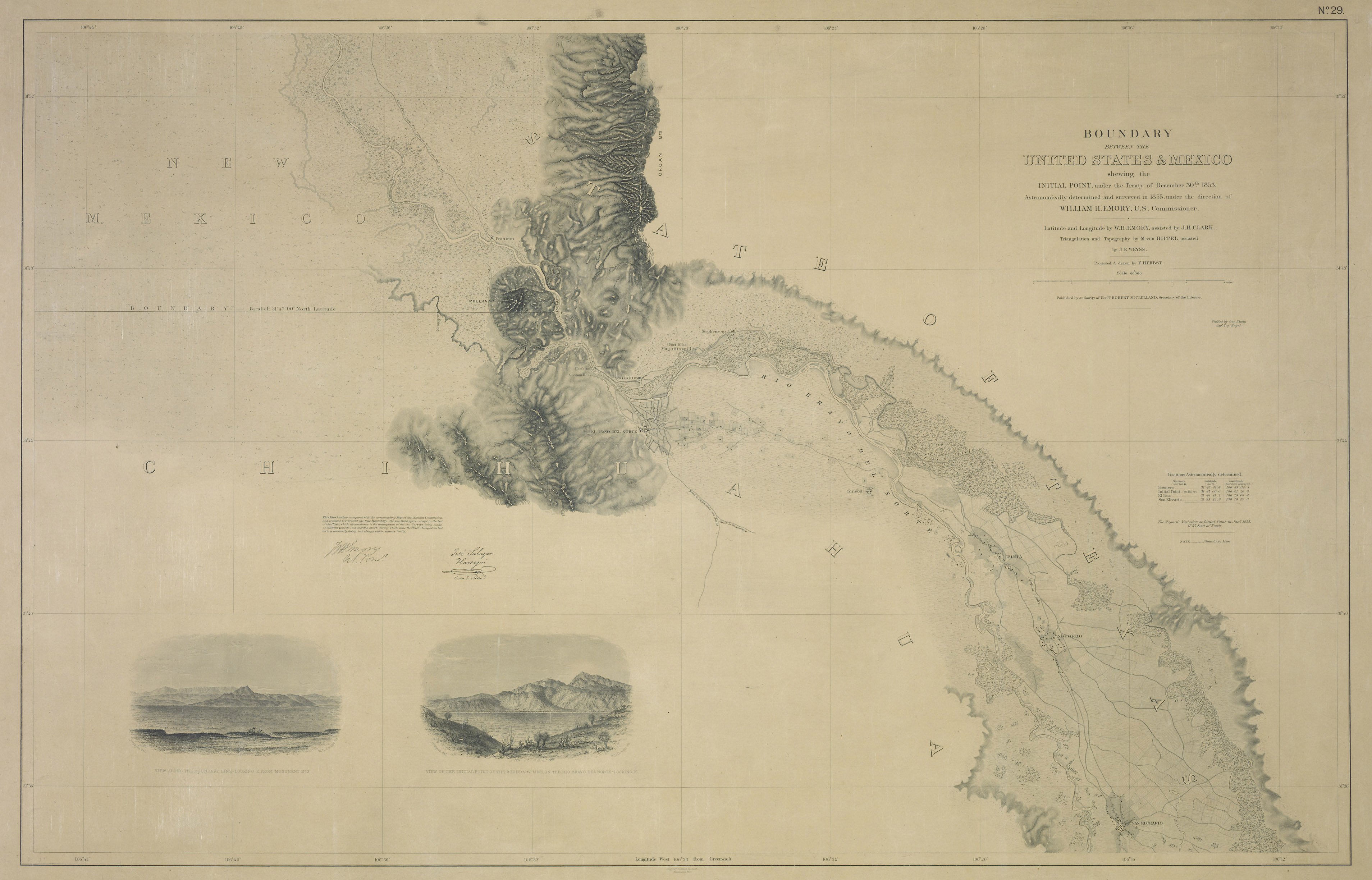
The Guadaloupe Hidalgo Treaty had called for the establishment of a mutually recognized border. From 1849 to 1855 each government created three commissions to survey different parts of the border area. In the following two years a fourth, joint commission determined the final line of the border. The map presented here is one of 54 maps drawn up by the fourth commission.
-
Records of the Boundary and Claims Commissions and Arbitrations, RG 76. National Archives.
(Bild anklicken für hochauflösende Version)
U.S. National Archives & Records Administration
http://www.archives.gov/publications/prologue/2005/summer/mexico-1.html